Patio Covers in Tradewind, TX
Southeast Amarillo, not southwest, wrapped around a general aviation airfield established in 1946. The local spelling is singular.
No obligation. Every estimate starts at the house, looking at the slab, the wall you would attach to and where the afternoon sun actually lands.
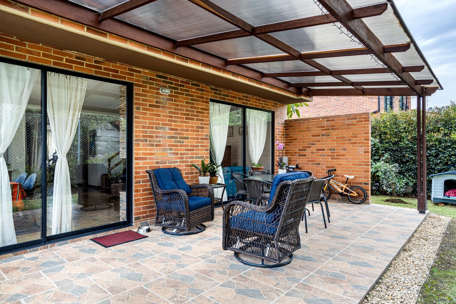 Attached patio cover · illustrative
Tradewind
Tradewind at a glance
Every figure below comes from a named public source. Where we could not verify something, this page says so instead of filling the gap.
Population from city population 197,979. Design wind and snow from ASCE 7-16 wind and snow hazard data; permit and code details from each jurisdiction's own published material.
Permits
City of Amarillo, on the southeast side
We confirm the current position for your specific address before quoting. Fee schedules and code adoptions change, and a page that was right last year is not a substitute for asking.
The Tradewind additions sit inside the Amarillo city limits in Randall County, confirmed against the Census geocoder, so City of Amarillo Building Safety has jurisdiction.
Two corrections worth making before anything else. First, the local spelling is singular: the recorded additions are Tradewind Air Park, Tradewind Square and Tradewind Industrial Park, the Amarillo ISD campus is Tradewind Elementary, and the airfield is Tradewind Airport. No plural addition exists in the City's subdivisions layer. Second, this is southeast Amarillo, not southwest, which is where people often place it by association with the newer southwest developments.
All five of these neighbourhoods sit inside the Amarillo city limits, so the City's Building Safety department has jurisdiction. Amarillo adopted the 2021 I-Codes effective January 2024: the 2021 IBC under Ordinance 8082, the 2021 Residential Code under Ordinance 8086, the 2021 Mechanical, Plumbing, Fuel Gas, Existing Building and Fire Codes under their own ordinances, the 2015 Energy Conservation Code and the 2023 National Electrical Code.
The permit trigger is quoted on the City's own page: any owner or authorised agent who intends to construct, enlarge, alter, repair, move, demolish or change the occupancy of a building or structure shall first make application to the building official and obtain the required permit.
The exemption list is where patio covers get decided, and it does not include them. The exemptions are one-storey detached accessory structures such as tool sheds and playhouses under 200 square feet; decks under 200 square feet that are no more than 30 inches above grade, not attached to a dwelling and not serving the required exit door; and window awnings projecting no more than 54 inches. There is no exemption listed for patio covers or carports, and an attached cover is not detached. So an attached patio cover in Amarillo requires a building permit.
Fees are published: residential remodel or addition at $0.32 per square foot with a $135 minimum, new construction at $0.50 per square foot, residential plan review at $81, a $13 technology fee on every permit, revision of plans $81 and re-inspection $68. That is a per-square-foot basis rather than a valuation table, which makes an Amarillo permit one of the few you can predict before you apply.
The ground
Wrapped around an airfield
The Tradewind additions run between roughly 35.156 and 35.178 north and 101.839 to 101.813 west, wrapping the airfield. Tradewind Airport, identifier TDW, is a privately owned public-use field about three nautical miles southeast of downtown Amarillo, at an elevation of 3,649 ft, with two asphalt runways, 5,098 by 60 ft and 3,000 by 60 ft, plus a helipad.
Airfield ground is flat and open by definition, which is the design point. There is nothing upwind to slow anything down, so the ASCE exposure C assumption of open terrain fits this ground about as well as it fits anywhere in the city. That raises the design pressure at the height a patio cover sits.
The 1970 Randall County survey does not name these additions, so we do not claim a specific soil unit. The Amarillo default applies: 24 inch minimum footing depth inside the city, footings designed for uplift rather than bearing, and drainage taken deliberately away from the house.
On the record
Open ground and an operating airfield
The Amarillo design conditions apply: 108 mph ultimate design wind speed, exposure C, 15 psf ground snow, 24 inch minimum footings. Hail makes up about 68 percent of severe reports across the forecast area and the mean annual wind speed is 12.9 mph.
The airfield is a genuine neighbourhood characteristic rather than a nuisance claim. In the twelve months to June 2009 the field recorded 32,790 aircraft operations, an average of 89 a day, 99.9 percent general aviation, with 95 based aircraft, mostly single engine. We could not verify any documented noise study or overflight relationship to the residential streets, so we are not going to characterise the noise. What we can say is that this is an active general aviation field with a long history and that the neighbourhood grew up around it.
The market
An aviation neighbourhood since 1946
Tradewind Airport was established in 1946 by Shelby Kritser, who died in an aircraft accident in 1966. Jimmy Whittenburg then owned and managed the field until 2001, when Perry Williams acquired it. A fixed base operator building went up in 2014 and a restaurant honouring Kritser opened on site in 2022. The Tradewind Airport Corporation has been a registered Texas corporation since August 1985.
The neighbourhood's identity follows the field. Tradewind Elementary, an Amarillo ISD campus on South Williams Street, has the Aviators as its mascot with a vintage biplane logo, which is about as direct a link between a neighbourhood and an airfield as you will find.
Recorded plat approvals in the City's subdivisions layer cover the recent phases only: Tradewind Air Park unit 20 in March 2014 and unit 21 in June 2015, Tradewind Square units through June 2020, and Tradewind Industrial Park units in 2016 and 2017. Units 1 through 18 of the Air Park have no approval date in the layer, so the original platting is not dated there. No verified neighbourhood-level home value data exists; city-wide, median property value is $213,900 and median household income $67,187.
What we build here
Outdoor structures in Tradewind
Patio Covers
A roof over the slab you already have. Aluminium, insulated panel or louvered, engineered for 108 mph wind and anchored for uplift.
What it involves →Covered Patios
Slab and cover together, where there is no usable patio yet. One pour, one structure, one set of footings designed as a whole.
What it involves →Outdoor Kitchens
Counter run, grill, gas, water and power under cover. The services get planned before the concrete, because afterwards is expensive.
What it involves →Questions
About building in Tradewind
Is it Tradewind or Tradewinds?
Singular, in official local use. The recorded additions in the City of Amarillo subdivisions layer are Tradewind Air Park, Tradewind Square and Tradewind Industrial Park, the Amarillo ISD campus is Tradewind Elementary, and the airfield is Tradewind Airport. No plural addition exists in the layer.
People use the plural conversationally, and there is nothing wrong with that. It just does not match the recorded names.
Does being near the airport change the design?
Mostly through exposure rather than through aircraft. Airfield ground is flat and open with nothing upwind to slow the wind, which fits the ASCE exposure C assumption closely and raises the design pressure at the height a patio cover sits.
We could not verify any documented noise study or overflight relationship to the residential streets, so we are not going to characterise the noise. What is on record is an active general aviation field with about 89 operations a day in the twelve months to June 2009.
Which part of Amarillo is this?
Southeast. Tradewind sits roughly three and a half miles southeast of downtown in Randall County, wrapped around the airfield between about 35.156 and 35.178 north.
People often place it southwest by association with the newer developments out that way. It is on the other side of the city, and it is a considerably older neighbourhood, since the airfield dates from 1946.
Cost
Price a cover for a Tradewind address
The calculators take your dimensions, your roof type, your wall and your jurisdiction, and return a band with the permit worked out rather than guessed at.
Next step
Send the address and a photo of the wall
What your exterior wall is made of, and which permit desk your address falls under, decide more about the project than the dimensions do.